Orinoco River Basin Report Card

Overall health score of the Colombian Orinoco River Basin:

B-

Moderately good health, but action needed now

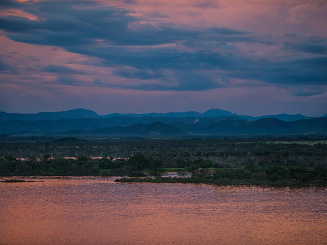
Every living thing—from plants to wildlife to people—depends on fresh water for survival. That’s why it’s important to understand how our actions impact the health of river basins, and what we need to do to make these valuable natural resources sustainable.

WWF, the University of Maryland Center for Environmental Science, and local partners teamed up to create report cards for river basins that provide a common understanding of a basin’s health, identify what’s important to water users, and foster a shared vision of the basin’s future. Report cards also track progress against global water management goals.

The Colombian Orinoco River Basin Report Card—the first of its kind in South America—came out in July 2016. Through a series of workshops held across the region, approximately 150 stakeholder came together to pinpoint the most important values and threats to their basin, known as indicators. What we learn about the health of each one of these indicators helps determine the overall health of the river basin. Researchers looked at data about the indicators and gave each one a health score. The team later averaged all the scores to reveal the final grade for the basin.

The Orinoco River Basin received a B-.

The report card serves as a model for building comprehensive, community-driven, scientifically credible basin assessments that can work around the world.

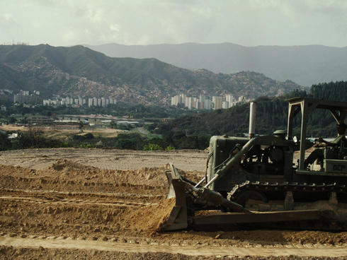
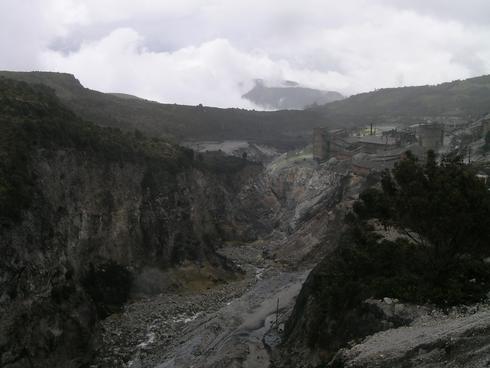
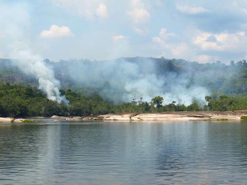
In its entirety, the report card shows a basin in transition, facing real and immediate threats from land use change, loss of forest cover, and ecosystem transformation. The results emphasize the need for integrated land use planning to ensure development occurs in a sustainable way.

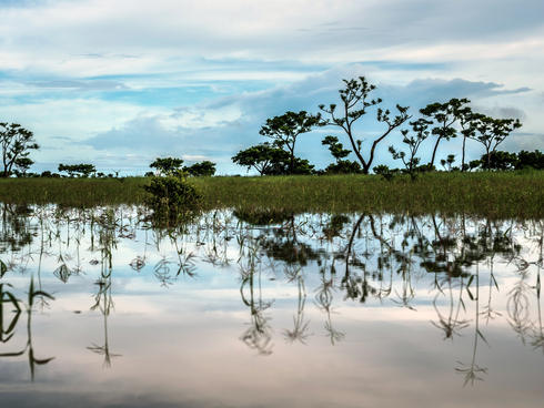
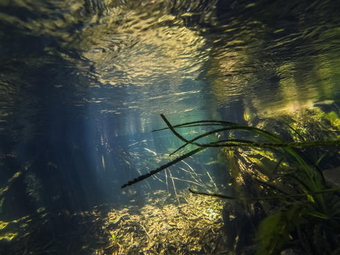
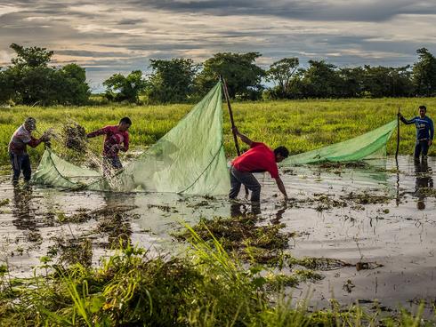
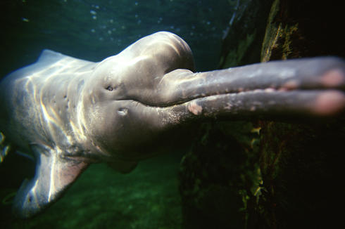
Take a look at some of the indicators below to learn more about the state of the Orinoco River Basin.

Indicators are standardized and scored on a gradient of excellent to fail.

A B C D F

The report card scored sixteen regions in the Orinoco River Basin.

Arauca Meta Casanare Meta Bajo Bita Tuparro Meta Medio Tomo Vichada Mataven Atabapo Guaviare Bajo Inirida Guaviare Medio Guaviare Alto Meta Alto Meta Manacacias

Water Stress

Orinoco River

Water stress refers to the amount of water that is available in the basin versus the amount that is demanded by various users—from communities to businesses to nature.

Water availability in the Orinoco Basin is good, but as the region continues to develop in sub-basins, such as the upper Meta and the Arauca, we are seeing reduced water availability.

More demand for water in certain regions due to expanding livestock, agriculture, and mining activities are threatening the resource. To protect the balance of supply and demand when it comes to water, WWF recommends improving assessments of environmental impacts when it comes to agricultural development and sustainability.

Water Quality

Orinoco River underwater

Water quality is determined by measuring the amount of certain chemicals, elements, and other components in water.

Various development activities—especially mining—are the main pressures affecting water quality in the Orinoco basin. Mining for construction materials and limestone is the likely contributor to the poor water quality observed in the Upper Guaviare, which in turn affects downstream portions of the basin.

Growing urban areas and new infrastructure also put pressure on water quality.

We need to better monitor the basin, especially where we see oil and gas development expanding, and improve planning and impact mitigation when it comes to mining.

Landscape fragmentation

Expanding city of Caracas

Habitats and the wildlife that live within them depend on various ecosystems physically connecting. Disconnection, often caused by human development, can reduce the ability of ecosystems to preform their functions—like cleaning water—and of animals to move between different habitats. Landscape fragmentation looks at how disconnected ecosystems have become, and therefore serves as a proxy for the loss of ecosystem functionality and animal movement between the rain forest, savannas, and wetlands in the basin.

Areas of major concern are upper portions of the Guaviare, and in particularly the Meta Basin.

WWF recommends improving the planning process for growth in agriculture and mining to help prevent habitat fragmentation, meaning that one swath of land is no longer connected to another.

Mining in Sensitive Ecosystems

Sulfur mine in Colombia

This indicator examines the presence of legal mining in places like paramos (high altitude grasslands), mountain forests, riparian forests, wetlands, and flooded savannas. These ecosystems are crucial to the health of basin but sensitive to development impacts.

Mining and similar activities are some of the major and widespread threats. The type of activity often varies between sub-basins, but much of it occurs in these particularly fragile ecosystems, causing rippling impacts throughout the system. In particular, the grades received by the Meta, Arauca, Guaviare and Vichada Rivers already show the current significance of this threat.

Because report cards can track how mining activities are permitted to happen in such sensitive places, we can better understand how management decisions are impacting basin health. Improved planning processes and efforts to better understand the impacts of extractive activities are critical steps to addressing this issue and improving basin governance.

Fires

Fire along the banks of the Orinoco River

Naturally occurring fires have shaped parts of the Orinoco’s landscapes for thousands of years. However, fires from unnatural causes can have grave consequences for ecosystems. This indicator looks at the frequency of unnatural fires in each sub-basin of the Orinoco.

The Meta and Guaviare Basins show an increase in the number of fires, likely associated with clearing land for agricultural purposes.

As the climate changes and these landscapes become increasingly vulnerable, and as agriculture continues to expand, it will be important to strengthen sustainability studies for agricultural and other productive uses to include biodiversity and water resources.

Human Nutrition

Men fishing in the Orinoco

Because people are also part of a basin, the report card includes indicators that reflect social, cultural, and health issues, such as the availability of nutritious food. Human weight data from the National “Survey of the Nutritional Status in Colombia” is currently being used as a proxy for nutrition in this report card.

Human nutrition in the Orinoco Basin is an issue of concern. The Atabapo, Inirida, and upper Meta Basins received the worst scores. In some cases this is due to changes in indigenous traditions or low soil fertility, whereas elsewhere it reflects low availability of fish as a food supply.

Sustainable food production should be a priority for development in these regions.

Number of River Dolphins

Amazon river dolphin

River dolphins are listed as a vulnerable species in Colombia, and the health of these animals is one indicator for the overall health of the basins where they live.

Dolphin populations in Bita and Guaviare are healthy. Unfortunately, we are seeing new threats from rapid development in the Meta, and infrastructure and mining activities are impacting populations in the Arauca.

Efforts should be made in the Arauca to improve connectivity—by ensuring roads and other development don’t impact the river, for example—to ensure safe passage for dolphins.. Additional study and data collection is also required to fill in missing dolphin information for the Inírida, Tomo, Tuparro, and Vichada Rivers.

In fact, WWF recommends improved study and data collection for biodiversity at large in the basin in the coming years. Dolphins were chosen as an indicator in the Orinoco because we know the most about this species, but the basin is so biodiverse we don’t even know what we don’t know.

Publications

Sub-basin Report Cards